The Estuary Technical Group’s mapping methods go national

By Laura Brophy

August 2020

Estuaries provide rich sustenance for salmon, other fish and wildlife -- and for people. Over the past 6 years, Estuary Technical Group (ETG) Director Laura Brophy, pictured above, has led the development of innovative, accurate methods for mapping these vital estuary habitats in Oregon and across the U.S. West Coast. Now, she's a core member of a team that is taking these new mapping methods national.

Estuaries provide a richly nourishing home for an abundance of creatures, large and small, like this sea lion...

..and this rough-skinned newt.

The new project is funded by the National Oceanic and Atmospheric Administration (NOAA) through the National Estuarine Research Reserve system (NERRS). It's led by Elkhorn Slough NERR near Watsonville, California, and all 29 NERRs will be involved in testing the mapping methods across the U.S.

National Estuarine Research Reserves of the United States

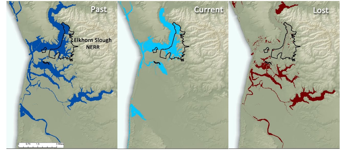
The foundation for this project was laid in 2014, when Laura and former ETG staffer Michael Ewald partnered with the Oregon Coastal Management Program to produce the nation's first statewide, elevation-based maps of estuary habitats. Laura then worked with the Pacific Marine and Estuarine Fish Habitat Partnership (PMEP) to apply the new methods to the whole U.S. West Coast. The resulting maps gave the ETG/PMEP team the means to produce the first comprehensive spatial data on estuarine wetland loss for the West Coast.

In the new nationwide project, Laura and her team will use the elevation-based estuary maps, along with other historical and current data, to build a better understanding of change in our nation's estuaries. The results will be used to inform restoration and conservation priorities at each study estuary – and to improve consistency of estuarine habitat mapping across our country's coastlines.

Read Laura's tidal wetland research published in the journal PLOS One.

The national project will produce maps of current and lost estuary habitats, like the ones above for Elkhorn Slough in California. These maps help people locate and prioritize areas to restore estuarine wetlands.